Offline Mobile Map Data Plotting App Examples
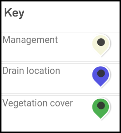
Examples of data maps created by students investigating the flash flood hazard risk and management at Sant Pere de Ribes, Barcelona. The maps can be dragged and clicking on the map markers displays data and images.
Map of the flash flood hazard risk and management at Sant Pere de Ribes (North), Barcelona (May 2018)
Source: Westcliff High School for Boys, 25 May 2018
Map of the flash flood hazard risk and management at Sant Pere de Ribes (South), Barcelona (May 2018)
Source: Westcliff High School for Boys, 25 May 2018
Offline Mobile Map Data Plotting App Help and FAQ
Offline Mobile Map Data Plotting App Screenshots

