Google Earth Teaching Ideas
Google Earth and the financial crisis
 |
| How Google Earth helps illustrate the impact of the financial crisis |
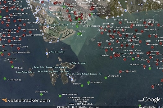
The worldwide economic downturn has led to a steep drop in global trade and exports. The image above, produced using a combination of Google Earth and a plugin from Vesseltracker.com, shows an unprecedented number of container ships sitting idle off Singapore in March 2009. The world's busiest port for container traffic, Singapore saw its year-over-year volume drop by 19.6 percent in January 2009, followed by a 19.8 percent drop in February. By mid-March 2009, 11.3 percent of the world's shipping capacity, or some 484 ships, sat idle, a record.
Source: International Economy
A lesson may be combined with video news footage of ships moored off Singapore: Ghost Fleet Ships In Limbo Off Coast Of Singapore Amid Global Recession.
