Water Supply in the Barcelona Region
Water in the Spanish Metropolitan Region of Barcelona is provided by a variety of companies (public, semi-public and private). Local, supra-local and regional institutions are in charge of aspects such as sewers, flood control works and wastewater treatment facilities. Part of the cost of these activities is financed by consumers through taxes included in the water bills. This makes Barcelona the most expensive city in Spain for water. Over the last 8 years, a significant social revolt has arisen in which some 80,000 families in the metropolitan area refuse to pay the taxes included in their water bills.
Three Main Issues:
- water supply: current and projected demand threatens current supplies
- water quality: wastewater is still untreated for 1 million people in region
- flood control: most of main fluvial networks are channelised. Increasing importance of flooding by secondary, ephemeral streams and precipitation
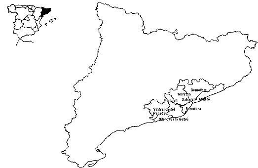
The location of the Barcelona region
Main Characteristics of Metropolitan Region of Barcelona
- The Barcelona Metropolitan Region is divided in administrative terms into seven "comarques" (equivalent to the English counties)
- Physiographic patterns show a narrow coastal plain, occasionally widened by river deltas, and a series of mountain ranges roughly parallel to the coastline and separated by undulating plains.
- Climate presents mild winters and warm summers, with a warming trend observed in the 1990s. Precipitation values oscillate around 500-700 mm a year, although means and averages make little sense in front of strong inter-annual and intra-annual variations.
- Population trends parallel the recent history of Mediterranean cities. That is, rural migration and concentration of population in large cities until approximately the mid 1970s, and the reverse processes in the 1980s and 1990s. Thus, from centralized compact urban forms and functions, the Barcelona region is undergoing a more dispersed pattern with an increasing presence of features of what we call the diffuse city (or "American model"): low density housing, a communications network built for private transportation, and proliferation of metropolitan sub-centres.
Fluvial Networks of the Barcelona Metropolitan Region
| River |
Basin area (km2)
|
Annual mean average flow (m3/s)
|
Minimum flow in a dry year (m3/s)
|
Maximum flow (m3/s)
|
Date of maximum flow
|
| Llobregat - Matorell |
4 561
|
20.7
|
1.69
|
3 080
|
21-9-1971
|
| Besos - Montcada |
1 032
|
3.88
|
1.8
|
2 345
|
25-9-1962
|
| Ripoll - Montcada |
242
|
1.19
|
0.40
|
1 234
|
25-5-1962
|
| Tordera - Can Serra |
802
|
5.65
|
0
|
1 280
|
20-9-1971
|
Llobregat Delta
The Llobregat River creates a delta of about 100 sq. kilometers that constitutes one of the most valuable natural areas of the Metropolitan Region of Barcelona. Since the 1960s, these wetlands and also traditional land uses such as agriculture have been under attack from the sea (expansion of the Barcelona harbour), from the air (expansion of the Barcelona airport ), and from the land (urbanization, industrialization, a dense road network, etc.).
Rieras
"Rieras" are the Catalan name for short, ephemeral streams. After the disastrous flood of 1962 (which killed almost 1,000 people in the region), many rieras were channelised and their floodplains developed for industrial and commercial purposes. Due to the climatological and hydrological peculiarities of Mediterranean ephemeral streams, the rieras suffer from extended periods of very low or non-existent flow occasionally altered by much shorter and violent flood episodes. Moreover, in periods of low flows the only water circulating in the streams comes from wastewater plants.
Extreme Events
- Floods and droughts are a common characteristic of Mediterranean water cycles. In the Barcelona region, there have been major floods in 1962 (with possibly 1 000 people dead), 1971, 1988 and 1994. Local flash flooding is becoming increasingly important, especially in the rapidly growing coastal plains north and south of the city. Diffuse inundation after storms with intensities of 200 mm/day or more is also becoming common.
- Drought conditions have become also more frequent in the 1990s. In 1990, for instance, the region barely escaped the imposition of supply restrictions. The winter of 1999-2000 has been in many localities the driest winter of the century although, in accordance with the Mediterranean climate, the following spring has been one of the wettest of the last decade.
Water Supply Sources
- To 1953: Groundwater
- 1953 - 1967: Groundwater and surface water from Llobregat River
- 1967 - 2000: Groundwater and surface water from Llobregat River and surface water from Ter River (water transfer approx. 100 kilometers long)
Water Resources
- the current structure demand shows that 61% of the water goes to domestic consumption, 23% to industrial activities and 16% to agriculture. Within the region, urban consumption appears to be declining in the city of Barcelona and in the immediate municipalities (due to population and industrial shifts) and growing rapidly in the periphery.
- Balance between supply and demand indicates that security margins are below desirable levels and that area is prone to a water deficit that is likely to become significant in 2010. Alternative sources of supply (water re-use, desalinization and transfer from another basin) are considered either unfeasible or insufficient by water authorities.
Water Prices
- The 23 municipalities of the Metropolitan Area of Barcelona have the highest prices for water in Spain (with Murcia and Palma de Mallorca).
- Whether this price is high or low depends obviously on family incomes. In Barcelona, it has been estimated that the water bill represents around 3 per cent of mean family budgets and may be significant for the lower income households of the central city and surrounding towns. Moreover, taxes represent a greater proportion of the bill than the service itself. In fact, an important rise in water taxes generated one of the most important social conflicts happening in Barcelona in the 1990s, with some 80,000 families, mostly from low income neighborhoods, refusing to pay these taxes.
Water Quality
- At the end of the 1980s, the rivers of the Barcelona region stood as possibly the most polluted and degraded of Western Europe. Since 1991 and after the European directive on urban wastewater, a comprehensive program of water treatment plants has been implemented and the situation has improved dramatically.
- Nevertheless, the quality index used by the regional government only includes physico-chemical parameters. When biological parameters are used, improvements are much more modest. The use of several biological indexes (FBILL, including the presence of macroinvertebrates, or QBR, using riverbank vegetation, indicates that ecological quality remains poor in most rivers).
- One of the main reason to explain poor ecological quality is that rivers lack enough natural flow for the dilution of water discharged from wastewater plants.
Major Changes and Pressures Expected
- increase in diffuse forms of urbanization - water demand
- differential impacts of water prices. Are citizens of the central city subsidizing citizens in suburbia?
- possible limits to the improvement of water quality
- possible effects of land use changes (i.e. afforestation in the supply basins) in water availabilty
- possible long-term effects on climate change (reduction of river flows by 50% around 2050).